
Future Plans
About
Future Plans
A church, a youth centre with housing above it, and a diocese centre — three buildings on the land at 169 Rice Road, drawn and filed with the town. None of it is built. This is what has been designed, and how far it has got.
A walk through the proposed buildings
Drawn by Dewing Schmid Kearns, with eight consulting firms under them







Three buildings, one courtyard
The church now worships in a building it did not build. It was put up for an Episcopal congregation, it was bought in 2016, and the altar, the screen and the icons in it were fitted into a room that was designed around a different service. How that happened is its own story. What was always going to follow from it is this one.
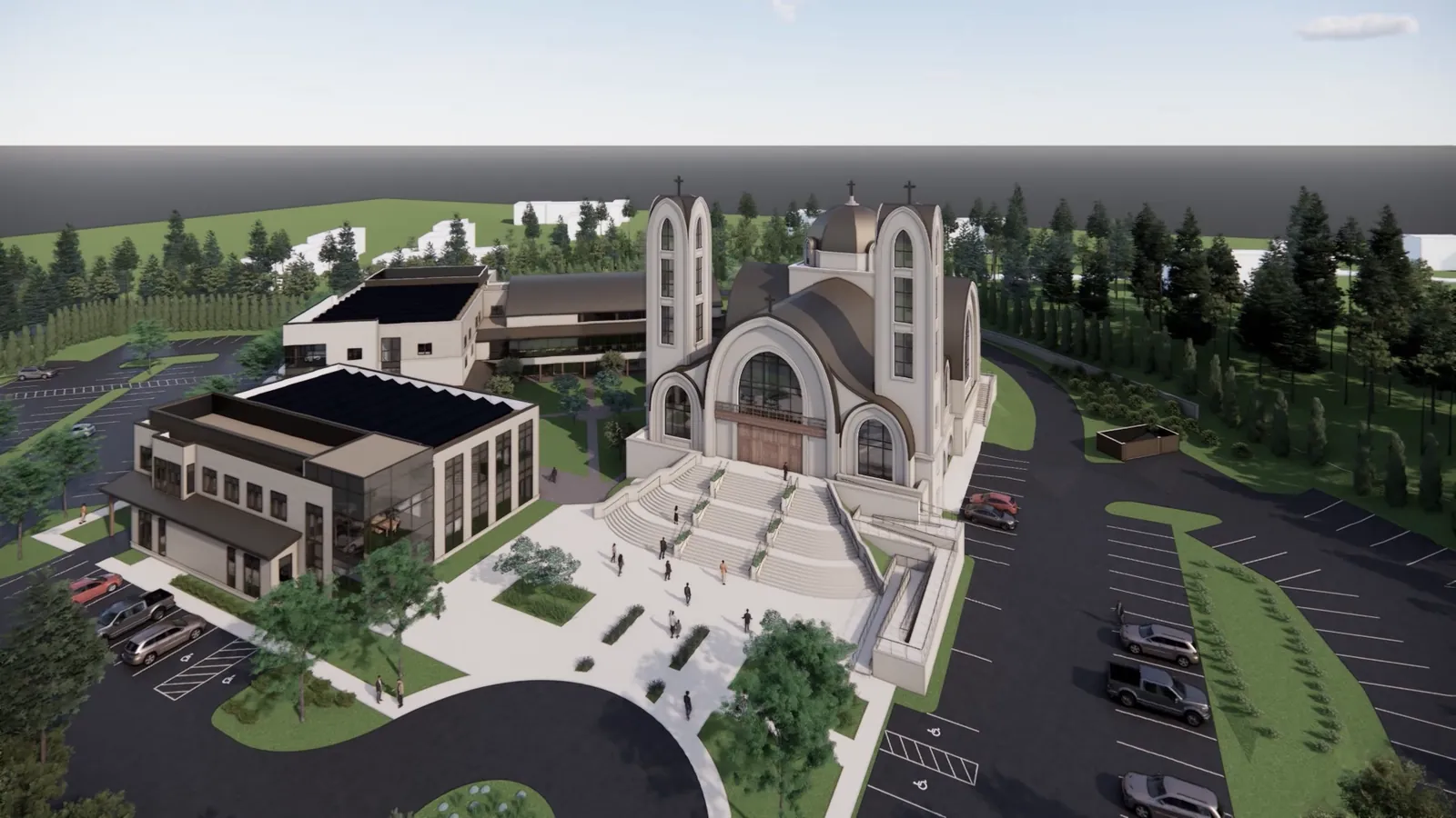
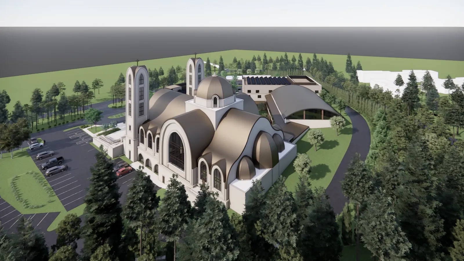
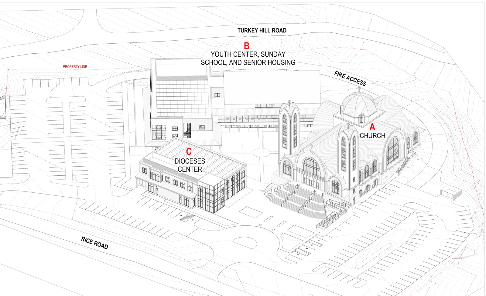
The design puts three buildings around a paved court. The church stands at the east end, on the highest part of the site, with its doors facing the car park across a broad flight of steps. Behind it and to the north runs the long building that holds the Sunday school on its lower floors and one-bedroom apartments above. Between them and Rice Road sits the diocese centre, the smallest of the three.
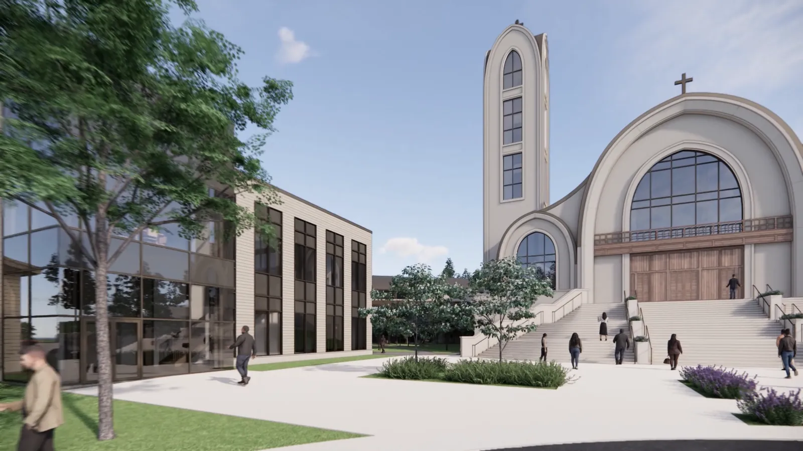
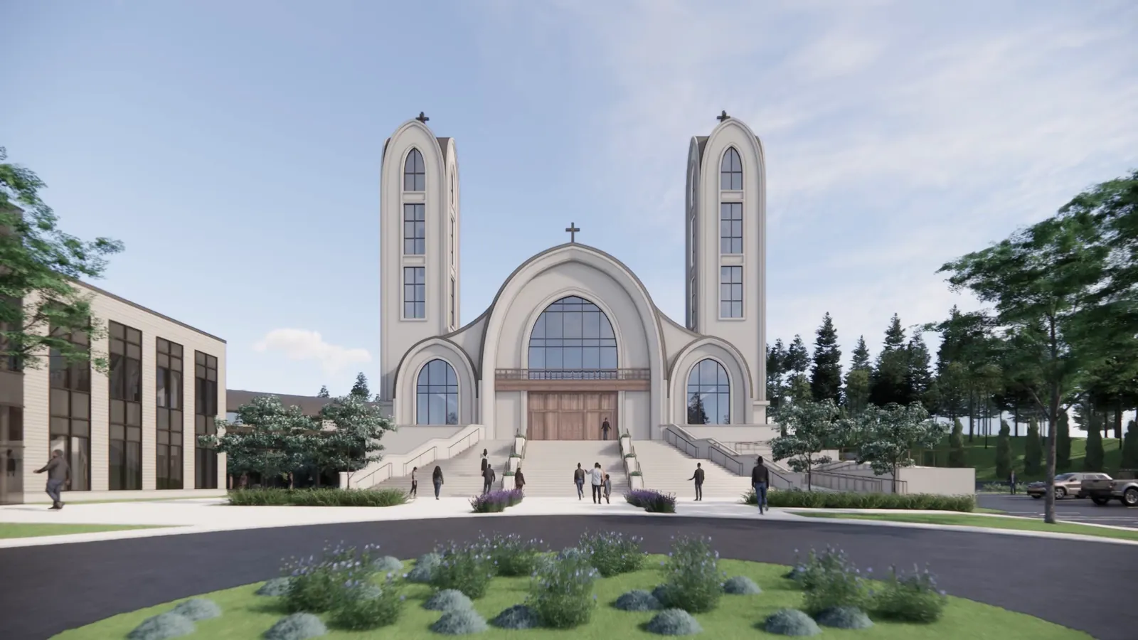
They are one project and they are not one building. The church is drawn in the Coptic language of arches, vaults and a dome; the other two are plainly and deliberately not, so that a reader driving past can tell at a glance which of the three is the church.
It has been drawn by an architecture practice with eight consulting firms working under it — structural, civil, traffic, code, mechanical, landscape, wetland and survey — and the drawings have been in front of the Wayland Planning Board since August 2025.
119,458
square feet
Across all three buildings and every floor. TOTAL BUILDING AREA schedule, sheet R0.
570
seats
The figure the parking requirement is calculated from on the site layout plan.
190
parking spaces
One per three seats, which is what the Wayland bylaw asks of a church. Six accessible.
5.5
acres
The existing lot. Map 40, Lot 008 — no land is being bought.
Building A
The church
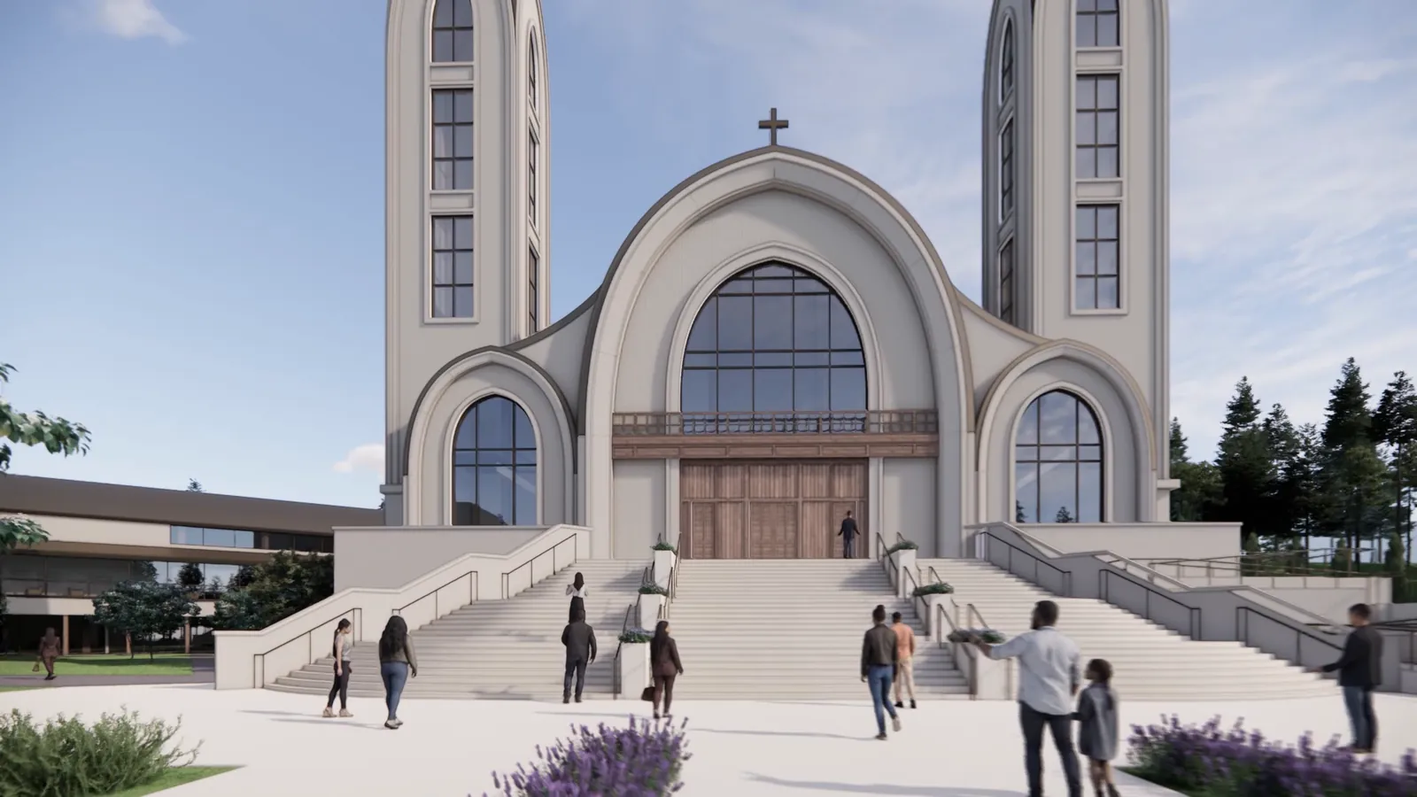
A nave of 5,429 square feet under barrel vaults, with a dome over the crossing and a gallery above the west end. Seating for 570 — about three times what the present building holds. The main altar stands at the east with a side altar to either side of it, which is the Coptic arrangement: three sanctuaries behind one screen, so that more than one Liturgy can be served on a morning when more than one is needed.
Around them the rooms a Liturgy actually needs and the present building improvises: a baptistery off the nave, a chamber for the relics, a room for the deacons to vest in, a chorus, and two crying rooms — one on each level — so that a parent with a small child can still see and hear the altar.
The floor of the church sits sixteen feet above the car park. That is the reason the approach is a flight of steps and the reason there is a ramp beside it, drawn at one in twelve with seven landings, so that the same doors are the way in for everybody.
It also means there is a whole floor underneath the nave, and that floor is where most of a Sunday actually happens: a dining hall of 4,050 square feet, a kitchen with a pantry and a receiving door behind it, a bakery for the bread, the bookstore, the three church offices, and a small chapel of 887 square feet for the weekday services that do not need 570 seats.
Building B
Sunday school, sport, and housing
The largest of the three at 60,458 square feet, and the one that carries most of what the church does between Sundays. Thirteen classrooms on the ground floor, from 487 to 665 square feet, with a nurse station and a staff kitchen among them and more Sunday school space on the floor below. A flexible room of 2,810 square feet, and a game room beside it.
Behind those, a full-size sports court of 7,400 square feet with locker rooms off it — a real court, marked for basketball, not a hall with a hoop at one end. It is the single largest room in the project after the nave.
Above all of it are twenty-one one-bedroom apartments across two floors, with a common room on each, reached by their own stairs and lift. They are drawn for older members of the congregation: housing on the same ground as the church, so that growing old does not mean leaving it.
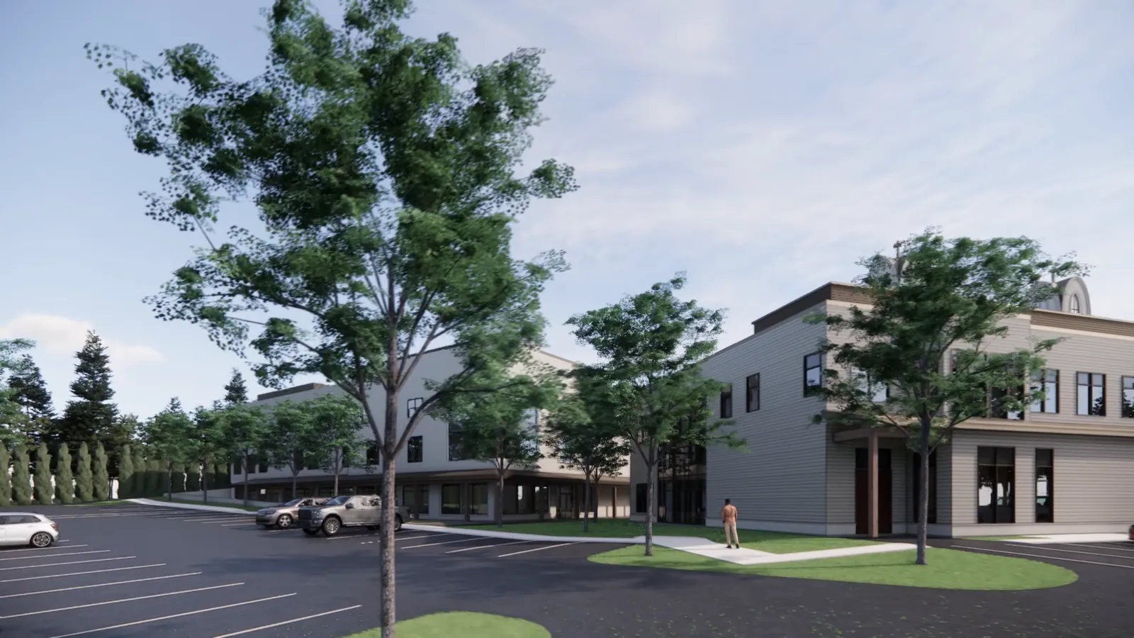
Building C
The diocese centre
The smallest of the three, at 23,983 square feet over three levels, and the one that serves beyond this congregation. Its ground floor is the function room — 5,639 square feet drawn with twenty-four round tables in it, its own kitchen and its own lobby off the car park, so a wedding or a funeral reception does not have to be held in the room the Liturgy was just served in.
Above that, offices, a conference room, a lounge and three apartments. Below it, a hall with dressing rooms either side.
It stands closest to Rice Road, on roughly the ground the present church occupies — which is the plain reason the present church has to come down before this one can go up.
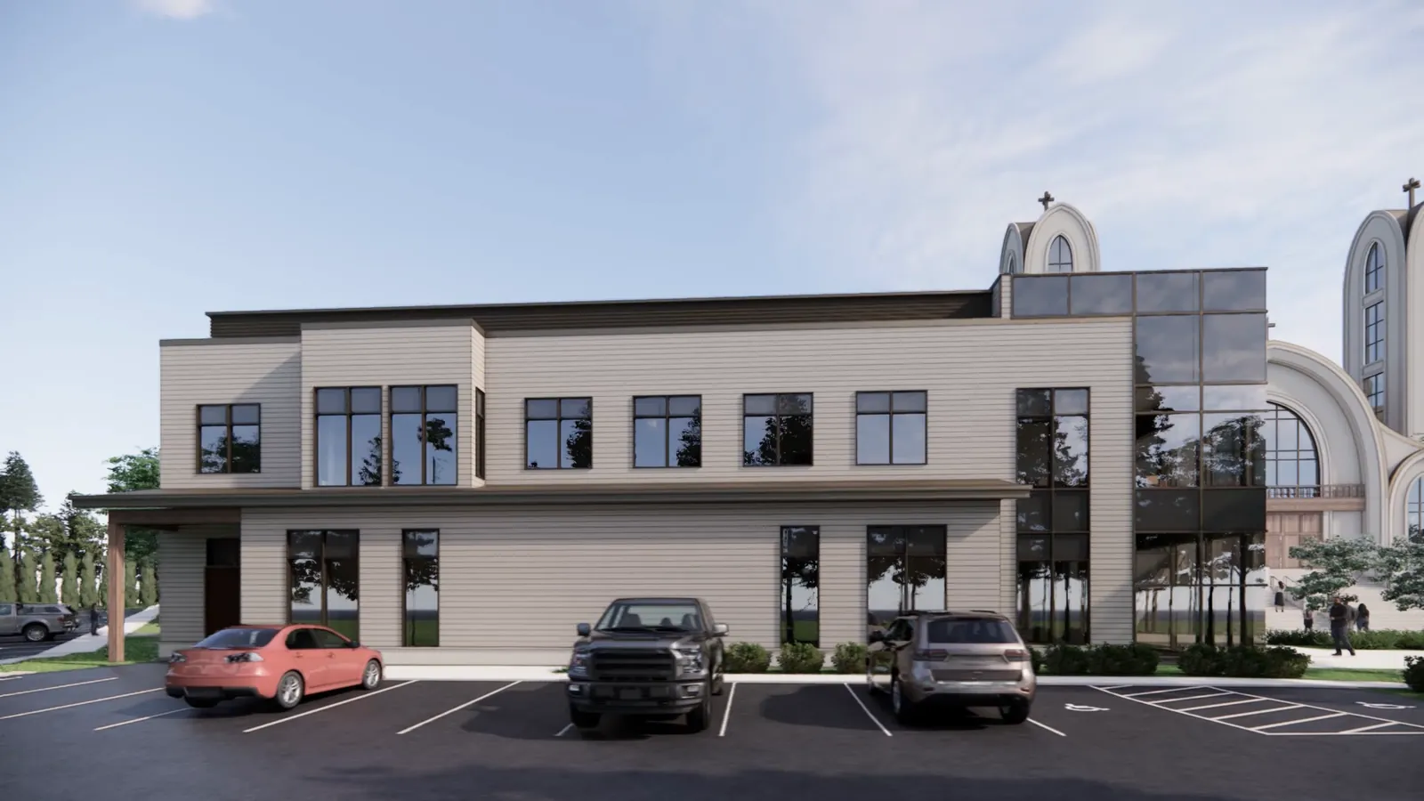
Ten more views
Walk round it
More frames from the same flythrough — the approach, the court, the two buildings behind, and the whole site from above. Open any of them.
119,458 square feet, accounted for
What the space is for
Straight off the schedule that repeats on every floor plan in the filed set, summed across the three buildings. The seven lines add to the total exactly.
- Function hall and parishioners’ needs27,736 sq ft
- The dining hall, the function room, the kitchens, the lobbies and the servery. Basement and ground floor.
- Sunday school24,055 sq ft
- Thirteen classrooms, a nurse station, lobbies and storage, on the basement and ground levels of Building B.
- Church and congregation22,521 sq ft
- The nave, the altars, the baptistery, the chorus, the deacons’ room, the foyer and the two crying rooms.
- Retreat, athletics and children18,514 sq ft
- A full-size sports court with locker rooms, a game room and a flexible hall.
- Residential17,889 sq ft
- One-bedroom apartments over the two upper floors of Building B, with a common room on each.
- Diocese7,240 sq ft
- Offices, a conference room and a lounge in Building C.
- Plant1,503 sq ft
- Mechanical, electrical and the rest of what a building this size needs and nobody sees.
Five and a half acres
How it sits on the land
The lot is the one the church already owns — Map 40, Lot 008, between Rice Road and Turkey Hill Road. No land is being bought, and the buildings are fitted to what is there.
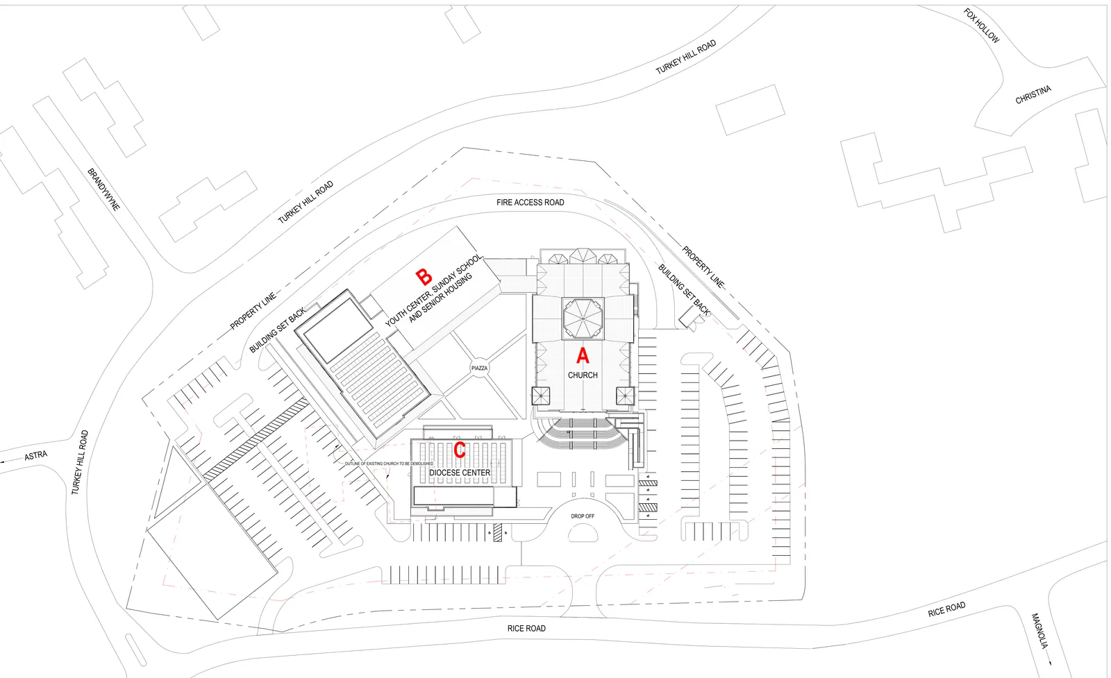
The three buildings are set back from both streets and turned inward, so that what they enclose is a courtyard rather than a frontage. The car park wraps around the outside: 190 spaces, six of them accessible, which is exactly what the Wayland bylaw asks for a church of 570 seats, and a fire access road runs the length of the north boundary.
Built footprint comes to 18 per cent of the lot against a limit of 20, and just under two acres is left as open space. A brook crosses the north-west corner of the property, and the drawings show the work inside its buffer measured, drawn and kept small — a little over two thousand square feet of it. Two species of native cedar are specified for the planting.
The present church is drawn on the site plan as a dashed outline marked outline of existing church to be demolished. That is the hardest line on the sheet, and it is the honest one: the congregation would be worshipping in the building on the day the drawings for its replacement are approved.
Nothing has been dug
Where the work stands
Dates below are the ones printed on the drawings themselves, not dates anybody remembers.
- 2016
- St. Mark of Boston buys the Church of the Holy Spirit at 169 Rice Road, and this church begins — in a building designed for somebody else’s liturgy.
- June 2025
- The architects issue the first renderings of the church itself — Building A, on its own, without the site around it.
- August 2025
- The full set goes to the Town of Wayland: three buildings, forty-odd sheets, and seven consulting firms named on the cover — civil, structural, code, mechanical, transport, landscape.
- November 2025
- First revision, marked “per town review”, together with the survey of abutters the process requires.
- December 2025
- Second revision, again per town review, and the compiled set that this page was written from.
- March 2026
- The flythrough above is delivered — the first time the three buildings are shown in colour, with materials on them.
- Next
- Site plan approval from the Wayland Planning Board. The endorsement line on the cover sheet is still blank, and every drawing in the set is stamped “not for construction”. Nothing has been dug.
Every sheet in the set is stamped not for construction, and the line on the cover reading date site plan endorsed is still blank. The design has been revised twice already in answer to the town's review, and it can be revised again. What is on this page is a proposal in front of a planning board, which is a real and specific stage and is not the same thing as a building.
Building it is the work of years and of the congregation's offering. If you want to know where it has got to since this page was written, ask the office — that answer will be current and this one will not.
Nine firms
Who is drawing it
A structural engineer, a traffic consultant, a code consultant, a wetland scientist and a licensed land surveyor, each named on the sheets they are responsible for. This is not a sketch somebody made for the church.
- Architects and planners
- Dewing Schmid KearnsConcord, Massachusetts
- Civil engineering
- Oak Consulting GroupNewburyport, Massachusetts
- Structural engineering
- Foley Buhl Roberts & AssociatesPortland, Maine
- Mechanical, electrical, plumbing and fire protection
- Buro HappoldBoston, Massachusetts
- Landscape architecture
- Crowley CottrellBoston, Massachusetts
- Traffic and transport
- MDM Transportation ConsultantsMarlborough, Massachusetts
- Building and fire code
- Code Red ConsultantsSouthborough, Massachusetts
- Wetland delineation and ecology
- Goddard Consulting
- Land survey and existing conditions
- Dillis & Roy Civil Design GroupConcord, Massachusetts
All views on this page are renderings by Dewing Schmid Kearns Architects + Planners, drawn for the church — eight of them frames from the flythrough of 19 March 2026, and two of them sheets from the set filed with the Town of Wayland in December 2025. Nothing here is a photograph, and nothing here is final.
Paying for it
The drawings are paid for. The buildings are not, and they will be built the way everything in this church is built — out of what the congregation gives.
When the form opens, change the fund to SPSM Construction Project. It opens on the general fund, and an offering left there supports the church's day-to-day work rather than this.
One offering or a recurring one, through the church’s Tithe.ly form. More ways to give.
More about the church
- Who we areA Coptic Orthodox church in Wayland, Massachusetts, and the Church it belongs to.
- Our beliefWhat the Coptic Orthodox Church confesses, and where that confession comes from.
- Our patron saintsSt. Philopater Mercurius and St. Mina, whose names this church carries.
- Welcome newcomersWhat happens in the liturgy, and what to expect if you have not been before.